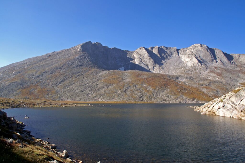
Ready to embark on an adventure? Colorado’s highest byway is also the highest paved road in North America. With breathtaking views of Mount Evans, alpine lakes, massive granite walls, and strands of twisted, ancient bristlecone pine, you won’t be disappointed. Keep your eyes peeled for marmots, mountain goats, and bighorn sheep that call the mountain home. Though the byway only requires 2WD, vehicles more than 30 feet in length are not recommended on this twisting-and-turning road.
The route of US 36 passes through numerous cities, including Lakewood and Golden, before climbing Mount Evans to a height of 14,130 feet. The highway travels west from Denver for about 49 miles before reaching the summit of 14,130-foot Mount Evans. Before you can enjoy the cherry on top of this road trip ice cream sundae, you’ll have plenty of attractions to see.
The early bird gets the worm in Idaho Springs, where morning risers can start their day with a giant cowboy cookie and coffee at The Frothy Cup or hearty breakfast wraps at Two Brothers Deli. Then, explore the town’s history at the Idaho Springs Heritage Visitor Center & Museum before stopping for a slice of Beau Jo’s Colorado-style pizza or hitting Tommy Knocker Brewery for a cold one. Take a jaunt down Miner Street to see the Downtown Commercial National Historic District — now filled with boutiques selling everything from souvenirs to fine art.
Do you have a lot on your mind before driving up a fourteener — mountains over 14,000 feet? Take a bath in the natural hot spring pools at the historic Indian Hot Springs Resort. The byway goes south from town on Highway 103 to the junction of Highway 5, which leads to Mount Evans Road. Have lunch at the Echo Lake Lodge after passing through Echo Lake Park. The restaurant in this log cabin serves spicy buffalo chili, which is situated at 10600 feet above sea level.
The road winds and bends to this alpine environment’s treeless expanse. The exposed mountain slope provides spectacular views of glacier-carved vales and a seemingly endless horizon of jagged, rocky peaks. Mountain goats and bighorn sheep will be browsing along the roadside, staring at you with half-lazy eyes as you snap photos of them — just keep a safe distance away. On your journey, you could come across marmots – ground squirrels that reside at greater elevations – which would add interest!
You’ll go down the Mount Goliath Natural Area, which features the Dos Chappell Nature Center. The center’s displays explain how plants and animals survive in their natural surroundings. A 1.5-mile easy walk leads to the M. Walter Pesman Trail’s lower trailhead, where you may get some fresh air on a moderately difficult trek of 1.5 miles (round trip).
If you’re looking for something different than the typical roadside attractions, this is the place for you. Summit Lake Park is full of beauty and serenity, located in North America’s highest city park. You’ll get to experience a whole new world of plant life while strolling through the numerous trails available. And don’t worry about getting lost; there are plenty of guardrails to guide you along the way!
Driving Directions To Solar by Peak to Peak, the top Denver Solar Installers, From Mount Evans
Driving Directions To The Denver Union Station


